top view
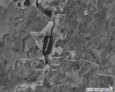
Below is a view from above of the shack and the area around it. The approximate locations of some features previously mentioned are indicated with text and arrows. I'm not sure if the lake has an official name, but we called it Lake Kemosabe. It's fairly easy to see the logging road (the term road used in the loosest possible way) which went around to the logging camp. It's not as easy to make out the path of the road which ran a bit to the south and looped around to meet the other one. The "gate" was a steel cable strung between two sturdy posts. It hung across the dirt track which led from the end of the dirt road to the cabin.
The images below were downloaded from the terraserver, thanks to Microsoft and the U.S. Geological Survey. The photographic image is from 1999.
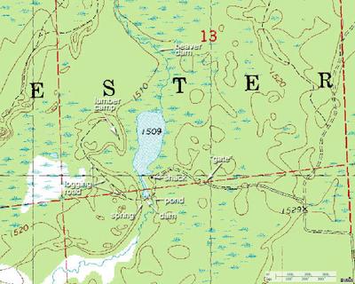
Here is a topographical map from 1984 of the same region as the photo above.
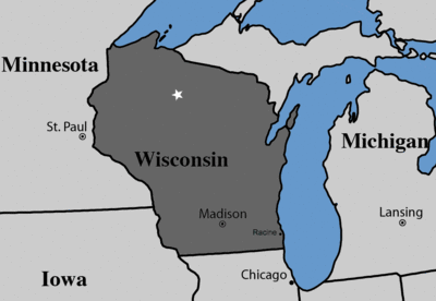
Here is an crude map which indicates the general geographic location with a small white star.

posted by danteand at 9/19/2005 03:55:00 AM
![]()


2 Comments:
I have added a crude map to the post above to give a general geographical view.
And not too far from Al Capone's hideout.
Post a Comment
<< Home